According to NOAA, the 2021 North American monsoon through July has been among the wettest on record for parts of Arizona. Some parts of Arizona have received more than 200% of the average rainfall, with Tucson recording its wettest month ever in July 2021. While the increased precipitation is a welcome relief for drought-stricken areas, it also brings the risk of damaging, destructive storms. Researchers at Embry-Riddle Aeronautical University are looking for ways to improve their forecasting and better predict the flash flood and severe thunderstorm events that impact Arizona.
Dr. Kevin Adkins, Associate Professor in the College of Aviation at Embry-Riddle Aeronautical University’s Daytona Beach Campus, is one of the lead investigators conducting field campaigns in Arizona and New Mexico this year. “It has been a banner year for the North American monsoon,” says Dr. Adkins. “We were worrying upfront when we started planning for this last fall that there wouldn’t be a monsoon because the past three years have been really trivial types of events. We were lucky this year because where we’re at in Arizona, it was very active. Yet there are places this year which are very wet and yet within the same region, very dry. So, what type of fine scale features result in that type of enhanced precipitation or the opposite? The overarching goal of our research is to better understand what triggers that very localized precipitation.”
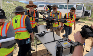
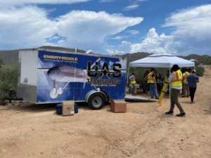
To that end, Embry-Riddle Aeronautical University enlisted personnel from their campuses at Prescott, Arizona and Daytona Beach, Florida to conduct this research project. Their approach involved a variety of manned and unmanned research vehicles, the use of which provided near continuous measurements of the lower atmosphere over the complex terrain found in northern Arizona.
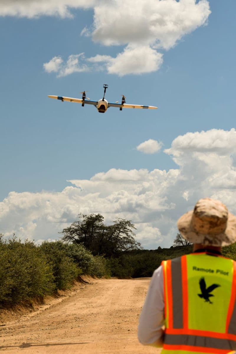
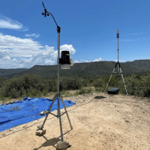
“This was a very complex operation involving four multi-rotor (Figure 2) unmanned aircraft systems (UAS), a fixed-wing UAS (Figure 3), manned aircraft, along with multiple weather balloon launches and a sophisticated distributed ground sensor network (Figure 4),” Dr. Adkins clarified. “The unmanned aircraft allowed us to investigate the unique weather phenomenon present during the monsoon season at a finer spatial and temporal scale than had ever been done before.”
Traditional forecast models rely heavily on fixed local weather stations located miles apart that fail to capture the meteorological interactions that occur over complex terrain. By using a fleet of manned and unmanned vehicles, researchers were able to capture measurements horizontally as well as vertically. The theory is that the denser and more frequent the data, the better the forecast.
All the vehicles involved in this field research were fitted with a suite of meteorological instruments to detect and measure humidity, temperature, pressure, and wind speed. By capturing data near the Earth’s surface as thunderstorms were forming, researchers hope they can more effectively monitor the timing and location of convective cells. By improving their understanding of these processes, they hope to enhance forecasting of the flash floods and severe thunderstorm events that impact the region.
“We set up in areas of known hot spots for monsoon-associated convection and analyzed the role topography plays in that process,” states Dr. Adkins. “Specifically, what we were looking at is convective initiation with respect to the monsoon set up and how the topography of the area contributed to that. So, things such as flow channeling and how that may enhance and promote or do the opposite for this type of convection.”
In launching the unmanned aircraft and weather balloons as storms were forming, researchers were able to capture detailed meteorological data from the lower atmosphere, an area that plays a critical role in the initiation of convective storms. Most computer models do not account very well for the complexities within the lower atmosphere. The teams from Embry-Riddle are looking to change that.
While the multi-rotor UAS and weather balloons delivered essential vertical wind and weather profiles, the fixed-wing unmanned aircraft, a Sentaero VLOS by Censys Technologies, enables the team to actively sample the lower portion of the boundary layer, something that cannot be done safely with manned aircraft. Dr. Adkins elaborates, “Since the fixed-wing UAS flies at a much slower speed, we are able to get a much finer resolution, but you do limit your area of interest to a much smaller area. That’s where the manned aircraft comes in: it, of course, has more legs—is able to get to higher altitudes and provides a little bit bigger picture. So, it’s really all about a multi-faceted observational strategy where the unmanned aircraft provides finer resolution; the manned aircraft providing intermediate resolution, and the weather balloon giving us the vertical dimension on a little bit larger scale.”
The TriSonica® Mini Wind and Weather Sensor was key to capturing relevant data from the VLOS airframe. The TriSonica Mini is an ultrasonic anemometer that captures the three-dimensions of the wind, along with temperature, pressure, humidity, and time. “There were a lot of ways, and a lot of things that could go wrong…in a very complex, multi-vehicle type operation with many concerns, this sensor was not one of them.”
“We were very pleased with the TriSonica Mini from the start,” attests Dr. Marc Compere, Associate Professor of Mechanical Engineering at Embry-Riddle Aeronautical University in Daytona Beach Florida. “It was plug-and-play, which is great. It has a simple, straightforward interface that proved to be easy to configure. The device was reliable. We had no issues with it at all, even though we added it in so late in the game—we had like two weeks to get it integrated, yet it was solid. It was as solid or better than any of the other wind sensors. Throughout our studies, the TriSonica Mini performed flawlessly. There’s nothing to tweak and it’s simple to use. You simply turn it on, it works, and it gives answers. Overall, this is an outstanding little product. I’ll be more direct about it. It is awesome! It’s really a great little product.”
As Dr. Compere mentioned, the addition of the TriSonica Mini sensor was last-minute, to say the least. Previously, the team had used a multi-hole pressure probe on the fixed-wing aircraft. With the monsoon research they wanted to obtain additional meteorological data that the TriSonica Mini could provide.
“We weren’t really sure how it was going to work,” Dr. Adkins states. “As Dr. Compere alluded to, we integrated this sensor at the very, very last second. But what really made a difference was the great support we were provided throughout the entire process. It was really second to none. I want to make sure that was acknowledged. We do appreciate it. It made such a difference.”
“This research was very challenging,” said Dr. Adkins. “We were relying on multiple vehicle operations, drone operations, a multitude of instruments on multiple vehicles. There might not be many people putting anemometers on drones, but I would suspect even fewer people are flying around with other drones conducting simultaneous operations to get a better snapshot of the atmosphere. It’s very challenging.”
“There were a lot of ways, and a lot of things that could go wrong and it was a pretty incredible effort, you know, multi-domain, multi-disciplinary, multi-vehicle, multi-sensor—a lot of stuff that could go wrong,” Dr. Compere emphasizes. “And in reality, a lot of stuff does go wrong, especially in a complex field campaign—it’s inevitable, but the TriSonica Mini was just rock solid. It was simple to integrate upfront and it was reliable in the field. That would probably be the thing that we appreciated the most about the sensor. So, in a very complex, multi-vehicle type operation with many concerns, this sensor was not one of them.”
Dr. Compere adds, “If I was to summarize our monsoon research, we are trying to help improve monsoon forecasts, which in turn, helps save people’s lives and property. Going out into the desert is science for sure, but the real purpose is to help people better understand monsoons and their effects. These flashfloods kill people and destroy property. So, improving weather forecasts helps people. It can save both lives and property.”
“It’s very compelling research,” says Dr. Adkins. “Everyone wants to be a part of it.”

Purchase Online
Get a Quote