Global Positioning System
Configuring GPS
In addition to displaying Latitude, Longitude, Coordinated Universal Time (UTC), and other GPS data in real time, the control unit can be configured to log GPS data in three ways: averages in the file header, associated with measurement records, or with GPS tagging.
- In the file header: When there are G records (GPS records) present in a file, averages are included in the file header (Figure C‑1).
- With measurement records: When an Above and/or Below record is logged, GPS data for that same place and time are logged in the same file, next to the associated measurement record. The record identifier for these GPS records will be G0 (Figure C‑1).
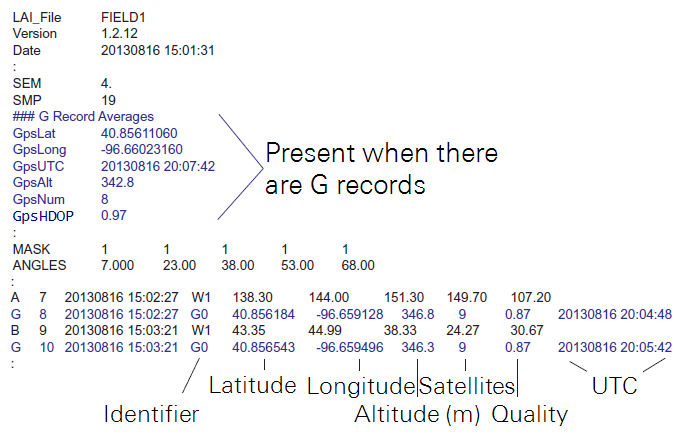
- GPS Tagging: If GPS is active (step 2 below) and a file is open, you can log a GPS record by itself. Simply press a numeric key (1–9) on the console. The G record identifier will be G1–G9, depending on the key that was pressed. This allows you to mark areas in your plot (the corners, for example) while making measurements, without logging spurious sensor readings (Figure C‑2).
Use these steps to activate and configure the GPS:
- On the console, go to MENU > Log Setup. Select GPS (bottom of list).
- Press the right arrow key to select Active–On. GPS data will now be displayed on the console in monitor mode. Press OK to finish, or go to step 3 to enable GPS logging.
- Press the down arrow key, then the left arrow key to select Log GPS–Yes.
- Press the down arrow and then select When–A, B, or Any. Press OK. GPS data will now be recorded with every Above reading, every Below reading, or with any reading.
GPS Fix Quality
HDOP, one of the variables in G records, stands for "Horizontal Dilution of Precision". It is a measure of the geometric quality of the configuration of satellites in the sky. The lower the number, the better the configuration and the better the fix quality. If all satellites are grouped close together, the triangulation gets worse, and HDOP goes up. An HDOP under 2 is very good. If HDOP is above 5, the GPS may not be seeing enough satellites in the right configuration for a good fix.
Mapping
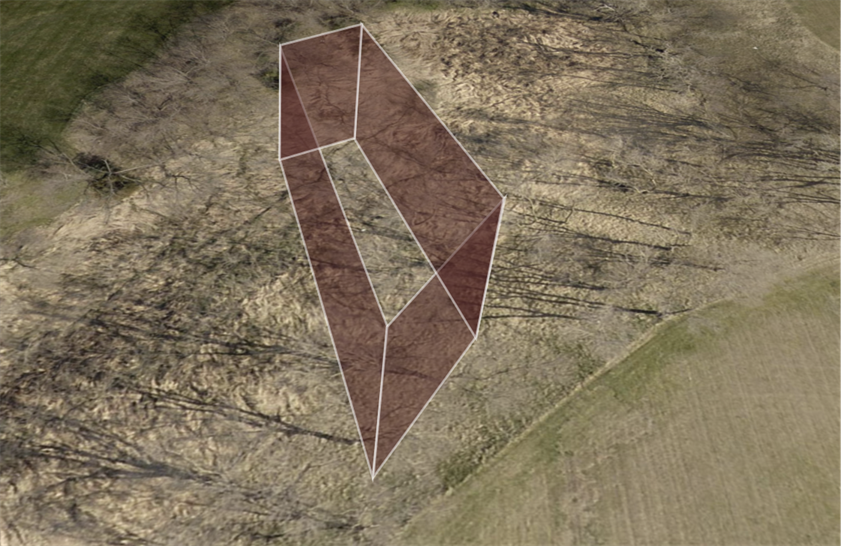
The map tool in FV2200 allows the export of location data as a .kml file for Google Earth, with several choices including a 3D representation of LAI along a path (see Make a GPS Plot).