LI-COR Cloud®
ACCESS AND SHARE REAL-TIME, TRUSTWORTHY DATA FROM ANYWHERE.
View Data PlansRequest a DemoWHAT IS LI-COR CLOUD?
LI-COR Cloud is cloud-based software for any Internet of the Environment (IoE®) enabled device that allows you to access its data from anywhere in the world. Using the IoE Module, measurement data is transmitted to LI-COR Cloud where it can be viewed, shared, or downloaded via the device's app.
EXAMPLE DASHBOARD
CORE PLATFORM FUNCTIONALITY
Remote access
View, share, and download data from your or your collaborators' labs from anywhere in the world.
Shareable data
Allow others to conveniently access your data—even if they do not own a LI-COR device themselves.
Tailored data analytics
Access detailed analytics built from your device's data streams within LI-COR Cloud.
Easy configuration
Follow a straightforward, guided configuration that anyone on your team can do—no technical expertise required.
NEW AUTOMATED ANALYSIS TOOLS
LI-COR Cloud now offers a powerful suite of analytics that run automatically—no manual processing required—and provides analysis-ready insights, so you can focus on discovery, not data.
CORE PROCESSING
Data Cleaning
Removes spikes, filters diagnostics, and standardizes datasets for trusted, report-ready results
Gap Filling
Transforms missing data points into complete datasets for continuous analysis-ready flux time series
Accumulation
Summarizes fluxes into daily, seasonal, or annual totals for quick and easy reporting, comparisons, and analysis
Footprint Analysis
Generates daily flux footprints and animated visualizations for further insights into your site
ADVANCED ANALYTICS
LI-COR CLOUD × FLUXMAPPER™
Transforms a single flux station into a spatial observatory that captures 95% of fluxes and links them to the landscape
LI-COR CLOUD × FLUXMAPPER
LI-COR Cloud × FluxMapper extends the power of eddy covariance by transforming point measurements into spatially explicit insights. By combining trusted LI-COR flux data with AtmoFacts™ advanced spatial analytics, FluxMapper reveals where carbon, water, and energy are moving across your landscape—not just at a single tower.
This integration helps you connect measurements to real-world conditions, improving how you interpret fluxes, evaluate land management decisions, and support carbon accounting workflows. The result is a more complete, actionable understanding of your system without adding more infrastructure.
GET EARLY ACCESSHOW IT WORKS
SEE BEYOND THE TOWER
Turn a single flux station into tens of thousands of virtual measurement points, delivering high-resolution FluxMaps™ across your area.
ATTRIBUTE SOURCES & SINKS
Identify where greenhouse gases are emitted or absorbed across landscapes in spatially explicit detail.
STRENGTHEN MRV & REPORTING
Generate transparent, audit-ready datasets to support carbon accounting, validation, and regulatory frameworks.
CONNECT DATA TO DECISIONS
Link flux patterns to land management practices, irrigation decisions, and environmental changes over time.
MAXIMIZE EXISTING STRUCTURES
Achieve broader spatial coverage and deeper insight without deploying additional towers.
USE DIRECT MEASUREMENTS
Leverage the eddy covariance method—the most direct way to measure ecosystem exchange—enhanced with advanced spatial attribution.
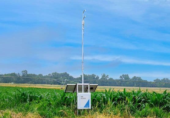
WATER AND CARBON NODES
LI-COR Cloud works with the Carbon and Water Nodes as a single, start-to-finish flux platform. Each Node collects data using field-ready hardware then its included IoE Module transfers data directly to LI-COR Cloud. LI-COR Cloud is where your team can view, share, and download data and where automated analysis takes over.

SEE IT IN ACTION
Get a tailored walkthrough of the LI-COR Cloud dashboard, automated analytics, and more.
REQUEST A DEMO