Measuring Evapotranspiration in Utah
The main objective of the Groundwater and Wetlands Group of the Utah Geological Survey, part of the Utah Department of Natural Resources, is to study, quantify, and disperse data related to groundwater in the state.
Paul Inkenbrandt, a Senior Geologist with the group, acknowledges that evapotranspiration (ET) is often the biggest unknown when tracking water coming into and leaving the basins, especially ET from crops and phreatophytes.
Currently, the state depends primarily on Reference ET and remote sensing estimates for evapotranspiration data. The Utah Flux Network has four eddy covariance towers that provide ground-truth for the remote-sensing estimates, and they are working to add five more.
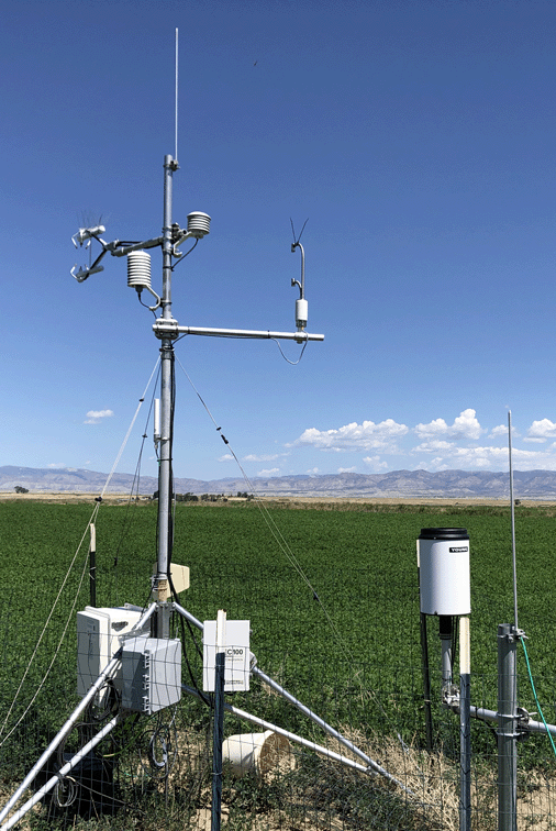
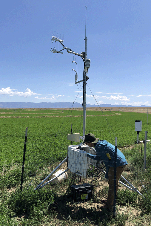
Inkenbrandt and his collaborator Kathryn Ladig deployed an LI-710 Evapotranspiration Sensor at an eddy covariance tower located between two alfalfa fields near the town of Wellington in central Utah. The station measures incoming and outgoing radiation, ET, ground temperature, heat coming off the ground, and CO2 fluxes.
The instrument has been in use since the middle of the irrigation season of 2022, and continues to collect measurements. Inkenbrandt and Ladig find the LI-710 results comparable to eddy covariance, even in winter with relatively low fluxes and little to no transpiration.
By having the LI-710 run parallel to the flux instruments, they have the benefit of redundancy of equipment, which was a good check on the measurements. “I can see this as a supplemental instrument at a full eddy covariance station already measuring flux,” Inkenbrandt said, “having that redundancy could be reassuring.”
‘I can see this as a supplemental instrument at a full eddy covariance station already measuring flux’
Inkenbrandt notes the ease and simplicity of the LI-710, and its common way of communicating with most data loggers or a Raspberry Pi. He finds the fact that the LI-710 does the intensive calculations and corrections convenient, although he sees a potential drawback for some in micrometeorology who wouldn’t be able to control the minutiae of the corrections. But since the LI-710 doesn’t require that micrometeorological expertise, he thinks it could potentially be set up in many more places across the state, such as the AgriMet stations that currently rely on Penman-Monteith estimates.
“If it’s deployed correctly, it’s a potential game changer,” he said. “It will not only allow for a greater number of places where ET is being measured, but you might be able to deploy it where a full-blown tower wouldn’t fit or be appropriate.”
‘It will not only allow for a greater number of places where ET is being measured, but you might be able to deploy it where a full-blown tower wouldn’t fit or be appropriate.’
There’s great interest in Utah, especially the Colorado River Basin, in measuring ET. Looking ahead to new technology that uses satellite data to estimate ET, Inkenbrandt sees a role for the LI-710.
“The new technology is only as good as the field check data that is available, so having field-based measurements is going to be crucial for checking and validating the satellite-based estimates that I think the Western states are going to eventually rely on for their water management decisions,” he said.
Measuring the amount of water being consumed, especially by agriculture, is important for Utah. Inkenbrandt sees the LI-710 as valuable for getting measurements of actual ET in many agricultural settings. “I think this will be useful, especially in the West,” he said.