
Wetlands can shift between taking up and releasing carbon dioxide as environmental conditions change. Sunlight, temperature, vegetation, water level, and weather can all influence this exchange, sometimes over relatively short periods of time.
For restoration projects, water-level management, or other changes in wetland management, understanding these shifts can help show how the ecosystem is responding. Traditional soil, water, or vegetation measurements provide important information, but they represent individual parts of the system rather than the continuous net exchange of carbon dioxide between the ecosystem and the atmosphere.
Eddy covariance provides a way to measure that exchange continuously over an area. This article looks at how eddy covariance can be used for carbon flux measurements in lakes, ponds, and wetlands, and some of the practical considerations when selecting a site, setting up a system, and working with the resulting data.
Key Takeaways
- Eddy covariance measures the rate of carbon dioxide exchange between an ecosystem and the atmosphere. It does not directly measure the amount of carbon stored in soil, vegetation, sediment, or water.
- Start with the question you want to answer, then design the monitoring approach around it. This may mean tracking changes at one site over time, comparing a treatment site with a reference site, or using multiple towers across a larger or more variable area.
- Representative tower placement, reliable power and access, routine maintenance, consistent data processing, and clear records all influence how confidently you can interpret carbon flux results.
How Eddy Covariance Measures Carbon Flux
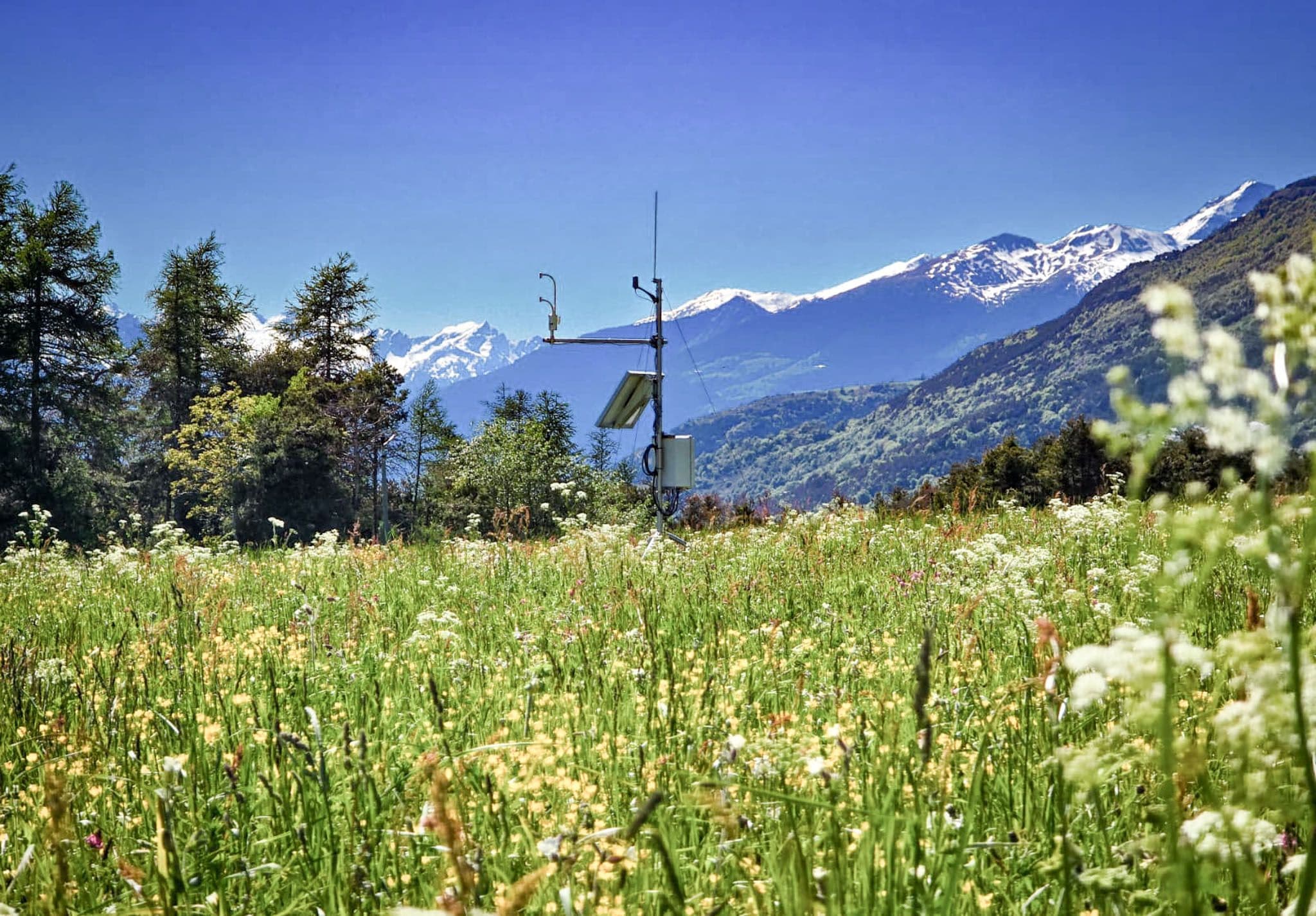
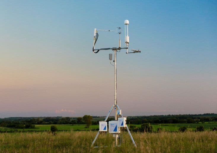
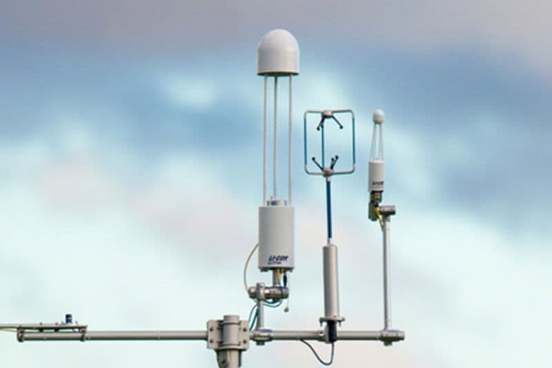
An eddy covariance tower measures both atmospheric conditions and the movement of gases. At a minimum, it typically combines two primary instruments: a sonic anemometer that measures three-dimensional wind and a fast gas analyzer that measures carbon dioxide concentration many times per second.
Air near Earth’s surface moves in turbulent swirls called eddies. By pairing the direction and speed of these air movements with the amount of carbon dioxide they carry, the tower calculates the net movement of carbon dioxide between the ecosystem and the atmosphere. This rate is known as carbon dioxide flux. It shows whether the measured area is releasing carbon dioxide or taking it up during each measurement period.

What Is a Flux Footprint?
Unlike a chamber or an individual soil sample, this result does not represent a single point. Instead, it represents an upwind area known as the flux footprint. The size and location of that footprint change with wind direction, instrument height, atmospheric conditions, and the surrounding surface. This is why selecting a representative site and positioning your tower correctly are important parts of the measurement process.
Carbon Flux vs. Carbon Stock
Carbon flux and carbon stock describe two different parts of the carbon cycle. Carbon flux is the rate at which carbon dioxide moves between the ecosystem and the atmosphere. Carbon stock is the amount of carbon stored in vegetation, soil, sediment, or water at a given time. Eddy covariance measures flux; it does not directly inventory these stored pools.
Continuous flux measurements can be accumulated across days, seasons, or years to show how carbon dioxide exchange changes over time. If your project also requires carbon-stock estimates, methane, nitrous oxide, or a complete greenhouse-gas balance, you’ll need to plan for additional measurements and instrumentation as well.
Five Steps to Take Before Monitoring Wetland Carbon Fluxes
Once you understand what your eddy covariance system will measure, the next stage is designing a strong, clearly defined project that can effectively answer your project’s questions. Follow these five steps below to guide you toward the right strategy.
1. Start with a Clear Project Goal
Before choosing your equipment, start to define the decision your measurements need to support. You may be evaluating a restoration project, comparing water-level strategies, testing a new treatment, or tracking carbon dioxide exchange over time.
Then identify the area and time period your results need to represent. Consider what other gases you may need to measure as well, so you choose the appropriate instrumentation, power, maintenance, and budget from the start.
2. Choose the Right Monitoring Design
Your project goal helps determine how many towers you need and when they should collect data. For instance, if you are tracking changes at just one site, you can monitor the same area over time with a single tower. If possible, begin taking measurements before any restoration or another intervention to establish a baseline, then continue measuring after the change.
If you are analyzing the effects of a treatment, use paired towers to monitor treatment and reference areas during the same period. Look for sites with similar wetland type, water depth, land-use history, topography, climate, and measurement coverage. If you want to evaluate a large, varied area, you may need multiple towers or a specialized spatial approach to account for contrasting surfaces within the project.
Lastly, the monitoring period should match your project goals. For standard measurements, the Harvesting Carbon: Lakes, Ponds and Wetlands guide recommends at least one year of data to capture seasonal variation and establish a baseline.
3. Select a Site That Represents Your Project
Eddy covariance works best when the tower has enough upwind area, or fetch, to represent the ecosystem of interest. In a large and uniform wetland, that may be relatively straightforward. However, in an area divided by open water, vegetation, roads, or surrounding land uses, your tower placement requires more planning.
Always review your site’s size and shape, wetland type, water depth, topography, vegetation, prevailing winds, and nearby boundaries together. These factors influence where the footprint falls and how much usable data the tower can collect from the target area.

Working with a large or varied area?
Watch this webinar to see how LI-COR Cloud × FluxMapper adds spatial context to your flux measurements.
Watch NowYour installation options may include a tower near the center of the site, a floating platform, one or more towers along a downwind shore, or multiple towers across a larger area. The best choice is the one that represents the entire project area while still being practical to install, power, and maintain by your team.

Need support with selecting, installing, or operating your systems?
Let the professionals help4. Plan Ahead for Power, Access, & Maintenance
A site that works scientifically also has to work operationally. Before installation, plan how you will power the tower, transfer data, reach the equipment, and respond when it needs attention. Remote access can help your team identify interrupted data collection or instrument problems without waiting for the next site visit. It does not eliminate maintenance, however. Your instruments still need to be inspected and cleaned, cables and connectors checked, power systems reviewed, and configuration changes documented.
Always include these responsibilities and long-term costs into the project from the start. A tower that is difficult to reach or maintain may experience longer data gaps, even if its original location appeared ideal for the measurement.
5. Create an Effective Data Workflow
Collecting raw measurements is only part of the process. Your project also needs a consistent approach to data processing, quality control, gap filling, accumulation, and footprint analysis.
Decide who will review the data, how questionable measurements will be handled, which processing settings will be used, and where each change will be recorded. For paired sites, use comparable procedures and time periods so differences in processing do not bias the comparison.
In addition, document site selection, tower placement, system configurations, maintenance, management changes, raw and processed data, and quality-control settings. If the project will support measurement, monitoring, reporting, and verification (MMRV), carbon credits, or regulatory reporting, identify the applicable requirements early so you collect the records reviewers will expect.

Want to simplify your data workflow?
Use LI-COR CloudTurn Your Monitoring Plan into a Project Protocol
You should now have the foundation of your monitoring plan: a defined goal, an appropriate measurement design, a representative site, an operating plan, and a path from raw measurements to final results.
The next step is turning your decisions into a complete, project-specific protocol. The Harvesting Carbon: Lakes, Ponds, and Wetlands guide provides the detailed framework for working through:
- Pre-planning and cost optimization
- Site, hardware, and software selection
- Tower setup and ongoing maintenance
- Data collection, processing, and quality control
- Reporting, independent review, verification, and auditing
With these pieces in place, your tower becomes more than a source of measurements. It gives you a consistent way to see how the ecosystem responds over time and whether a restoration or management practice is producing the change that your team is ultimately working to achieve.
Ready to Build Your Wetland Carbon Monitoring Protocol?
Download the Harvesting Carbon: Lakes, Ponds, and Wetlands guide for a step-by-step framework you can adapt to your project, site, and reporting requirements.
Download Now

Want to See the Measurement Approach First?
Watch this for a practical introduction to direct flux measurements, monitoring designs, and the guide’s protocol framework.
Watch NowNEVER MISS OUT ON ANOTHER POST
SUBSCRIBE TO OUR NEWSLETTERJOIN OUR COMMUNITY TODAY!